DEDICATED TO PRESERVATION, RESTORATION & REVITALIZATION OF THE MOSHASSUCK RIVER
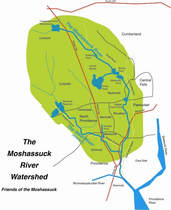
Map
West Tributary Looking West from Bridge
From a viewpoint from above, the West tributary runs downhill towards its reunion with the Moshassuck (as seen in shot 4 on the map). Compare taking a single view of a stretch of river from above versus getting down near the river to gain a panoramic view. The river looks similar on the other side of the bridge but with more flora blocking view of the water.
From a viewpoint from above, the West tributary runs downhill towards its reunion with the Moshassuck (as seen in shot 4 on the map). Compare taking a single view of a stretch of river from above versus getting down near the river to gain a panoramic view. The river looks similar on the other side of the bridge but with more flora blocking view of the water.
|
|